- County Facilities Location Map
- Fire Permit Map (Large Fire Permit Map)
- Landfill Locations Map
- RCMP Lac La Biche County Crime Map
- Ownership Map (South)
- Ward Maps
COUNTY MAPPING SYSTEM
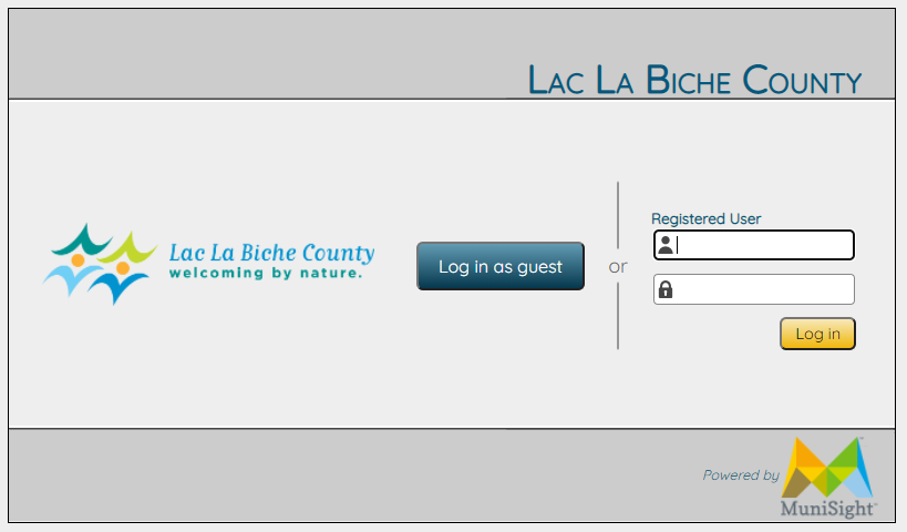
The County's web-based mapping system allows you to view property boundaries, County roads, utility lines, and other details that everyday residents, developers, real estate agents, and more will find useful.
Instructions
- To log in to the system, click the link above.
- Click the "Log in as guest" button.
- You'll be asked to accept an agreement before proceeding. Please read through the agreement, then click the "Accept" button.
- You'll have access to public information via the MuniSight app.
Viewing Features
The menu on the left can be used to turn mapping layers on or off, giving you information about land and other features in Lac La Biche County.
You can use the zoom tool to select an area of the County that you'd like to see in greater detail.
The menu on the left-hand side of the screen can be used to turn on/off various layers containing information about land in our municipality. You can also use the zoom tool to select an area of the County that you wish to see in more detail. At the top-left of the legend are three viewing choices (Legend, Searches, Routing) that can be used to view different types of information.
Legend: this view shows you map with all the features you select using the left-hand side of the menu.
Searches: this allows you to search by groups. Click on the drop-down menu to select parcel, address, legal location, transportation, Latitude/Longitude or PD (permit number). Enter the location of the map you wish to view under each one of these selections.
Routing: allows you to enter two points on the map and determine a distance between them.
Basic Navigation
Selecting a Location: simply click on the area of the map you wish to see in greater detail.
Zooming in and Out: there is a menu at the top-left of the map image with a magnifying class and a +/- symbol. You can also use the slider. Or, use your mouse wheel to zoom in on the map image.
Moving Around: left-click and hold your mouse on the map. The portion of the map you click on will be highlighted in green. You can drag the map in any direction from there. To move again, re-click the map and drag.
Local Maps
Please select the type of local map you wish to see from the menu below and then zoom in to view it more closely.
Facebook